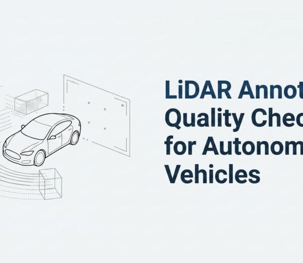
Introduction
In an era where technology is advancing at breakneck speeds, LiDAR (Light Detection and Ranging) has emerged as a pivotal technology that is reshaping industries such as autonomous driving, robotics, smart cities, and geospatial intelligence. At its core, LiDAR is a remote sensing technology that utilizes laser beams to measure distances between the sensor and surrounding objects, producing precise 3D representations of environments. However, for these systems to understand and utilize the vast amounts of LiDAR-generated data, accurate data annotation is essential. LiDAR data annotation is the process of labeling and categorizing point clouds, which is critical for developing and refining machine learning models used in various applications.
This comprehensive guide delves into the world of LiDAR data annotation, exploring its significance, methodologies, challenges, tools, and its role in the future of technology.
Understanding LiDAR Technology
LiDAR, initially developed for military and geological applications, has found widespread use in modern technological systems. It operates by emitting laser pulses and measuring the time it takes for these pulses to return after hitting an object. This time delay helps determine the distance between the LiDAR sensor and the object, creating a detailed point cloud representing the environment in 3D.
1 How LiDAR Works
LiDAR consists of three primary components:
- Laser emitter: Sends out thousands to millions of light pulses per second.
- Sensor or detector: Captures the reflected light, measuring the time taken for the laser to return.
- GPS and IMU: These provide geolocation and orientation data to accurately place the LiDAR data in context.
When combined, these elements allow LiDAR systems to generate highly accurate 3D models of their surroundings. Depending on the application, LiDAR can be mounted on vehicles, drones, aircraft, or satellites.
2 LiDAR vs. Other Sensing Technologies
LiDAR is often compared to other sensing technologies such as radar and cameras. While radar uses radio waves to measure distances and cameras provide visual data, LiDAR excels in accuracy, especially for measuring fine distances and detecting objects at long ranges, even in poor lighting conditions.
Importance of LiDAR Data Annotation
While LiDAR sensors capture vast amounts of data in the form of point clouds, these raw datasets are essentially meaningless without proper annotation. Annotating LiDAR data allows machines to understand and interpret the 3D world, helping in applications such as object detection, scene segmentation, and tracking.
1 The Role of LiDAR Data Annotation in Autonomous Driving
Autonomous vehicles rely heavily on LiDAR data to navigate through complex environments. LiDAR helps these vehicles detect pedestrians, other vehicles, road signs, and obstacles. For instance, Tesla, Waymo, and other major players in the autonomous vehicle industry invest millions into LiDAR data annotation to improve their AI models. Without accurate annotations, vehicles would be unable to recognize and differentiate between various elements in their environment, leading to catastrophic consequences.
2 LiDAR Data Annotation in Smart Cities
LiDAR plays a key role in the development of smart cities by providing detailed 3D maps of urban environments. Accurate annotation of LiDAR data aids in infrastructure monitoring, traffic management, and the optimization of public services. For instance, annotated LiDAR data can be used to monitor building integrity, assess traffic flow, and even manage energy consumption in real-time.
3 Robotics and LiDAR Data Annotation
Robotics systems, especially those operating in dynamic environments like warehouses, rely on LiDAR for navigation and obstacle avoidance. Properly annotated LiDAR data enables robots to create accurate maps of their surroundings, detect objects, and make decisions in real-time.
The Process of LiDAR Data Annotation
LiDAR data annotation is a meticulous process that requires both human expertise and advanced software tools. The main objective is to label different elements in the point cloud, such as vehicles, pedestrians, buildings, and other objects of interest. The process typically involves the following steps:
1 Data Preprocessing
Before annotation begins, LiDAR data often needs to be cleaned and preprocessed. Raw LiDAR data can contain noise, outliers, and irrelevant information that could impede the annotation process. Preprocessing steps include:
- Noise removal: Filtering out erroneous points caused by atmospheric interference or sensor errors.
- Downsampling: Reducing the point cloud density to optimize computational efficiency without losing important details.
- Segmentation: Dividing the point cloud into smaller, manageable segments that can be more easily annotated.
2 Manual Annotation
In manual annotation, human annotators label each point in the cloud according to its corresponding object or feature. This can involve:
- Object labeling: Identifying and categorizing objects like cars, pedestrians, trees, and buildings.
- Bounding boxes: Drawing 3D bounding boxes around objects to delineate their position and volume.
- Semantic segmentation: Assigning a class label to every point in the cloud to describe its category (e.g., road, building, vegetation).
Manual annotation is labor-intensive but essential for generating high-quality datasets. In industries like autonomous driving, where safety is paramount, the accuracy of annotations can directly impact the performance of AI models.
3 Automated and Semi-Automated Annotation
As the demand for large-scale annotated LiDAR datasets grows, automated and semi-automated annotation tools have been developed. These tools leverage machine learning algorithms to expedite the annotation process. They can detect objects and label points automatically, but still require human oversight to ensure accuracy.
- Automated tools: These tools can identify certain objects like vehicles and pedestrians based on pre-trained models. While they reduce the workload for human annotators, they can sometimes struggle with edge cases or novel environments.
- Semi-automated tools: In this approach, algorithms assist annotators by suggesting labels and bounding boxes, which can be manually adjusted as needed. This strikes a balance between speed and accuracy.
4 Quality Assurance
Quality assurance (QA) is a critical phase in LiDAR data annotation. After the initial annotation, the data undergoes review to ensure that all objects are labeled correctly and that the annotations meet predefined quality standards. QA often involves multiple rounds of reviews, with feedback loops to correct errors and inconsistencies.
Types of LiDAR Data Annotations
There are several types of LiDAR data annotations, each serving different purposes depending on the application. Understanding these types is crucial for selecting the right annotation strategy for a given project.
1 3D Bounding Box Annotation
One of the most common types of LiDAR annotation, 3D bounding boxes, involves drawing three-dimensional boxes around objects in a point cloud. These boxes define the spatial extent of objects, such as cars, bicycles, and pedestrians, allowing machine learning models to detect and track these objects.
2 Point-Level Annotation
In point-level annotation, each individual point in the LiDAR point cloud is labeled with a specific class. This method is particularly useful for applications that require high precision, such as mapping and scene segmentation.
3 Semantic Segmentation
Semantic segmentation involves classifying every point in the point cloud into different categories (e.g., road, building, pedestrian, vehicle). This type of annotation is widely used in autonomous driving, where understanding the context of the entire scene is essential for making safe driving decisions.
4 Instance Segmentation
Unlike semantic segmentation, which labels each point by category, instance segmentation also differentiates between individual objects within the same category. For example, instance segmentation can distinguish between two pedestrians standing next to each other in a point cloud, even though both are classified as “pedestrians.”
5 Object Tracking
In object tracking annotation, the movement of objects is labeled over time across multiple LiDAR frames. This is crucial for applications like autonomous driving, where understanding the trajectory of moving objects (e.g., cars, cyclists) is essential for predictive modeling and real-time decision-making.
Tools and Platforms for LiDAR Data Annotation
LiDAR data annotation requires specialized tools and platforms that can handle the complexity and scale of 3D point cloud data. Below are some of the leading tools in the industry:
SO Development:
SO-Development is a distinguished player in the LiDAR annotation services market. Known for their meticulous approach and innovative solutions, SO Development has carved a niche for themselves in various high-demand sectors.

Labelbox
Labelbox is a powerful annotation platform that supports LiDAR point cloud annotation along with 2D image and video annotation. It offers a collaborative environment where teams can label, review, and manage large datasets. It includes automation tools, such as auto-labeling, that reduce manual work.
Supervisely
Supervisely is an end-to-end platform for data annotation, focusing on both 2D and 3D data. Its LiDAR annotation capabilities allow users to create 3D bounding boxes, segment objects, and track movements across multiple frames. The platform also integrates AI-based automation for faster labeling.

Scale AI
Scale AI specializes in providing high-quality data annotation for machine learning. Its LiDAR annotation tools offer 3D bounding box annotation, semantic segmentation, and object tracking. Scale AI is known for its large workforce of annotators and its ability to handle complex and high-volume datasets.
CVAT (Computer Vision Annotation Tool)
CVAT is an open-source tool developed by Intel for annotating both 2D and 3D data, including LiDAR point clouds. It provides a flexible framework for manual and semi-automated annotation, making it a popular choice for research and academic projects.

Challenges in LiDAR Data Annotation
LiDAR data annotation is not without its challenges. The complexity of point clouds, combined with the need for high accuracy, presents several obstacles:
1 High Complexity of Point Clouds
Unlike 2D images, LiDAR point clouds are highly complex. Each point in a cloud represents a 3D coordinate, and in dense urban environments, the sheer volume of data can make manual annotation extremely time-consuming.
2 Lack of Universal Standards
There is no universal standard for annotating LiDAR data, leading to inconsistencies between different projects and datasets. Each application, whether autonomous driving or robotics, may have different requirements for how objects should be labeled and categorized.
3 Limited Annotator Expertise
LiDAR data annotation requires specialized knowledge, as annotators need to understand the intricacies of 3D data and spatial relationships. Training annotators to a high level of competence can be time-intensive, and there is a shortage of skilled labor in this area.
4 Edge Cases
In real-world environments, LiDAR sensors encounter a variety of edge cases that can challenge even the most sophisticated AI models. For example, objects partially obscured by other objects, extreme weather conditions, and highly reflective surfaces can produce ambiguous or incomplete point clouds that are difficult to annotate accurately.
Future of LiDAR Data Annotation
As LiDAR technology continues to evolve, so too will the field of LiDAR data annotation. Emerging trends and innovations promise to make the process faster, more accurate, and more scalable.
1 AI-Driven Annotation
AI and machine learning are expected to play an increasingly prominent role in LiDAR data annotation. Automated annotation systems will continue to improve, reducing the reliance on human labor. As these systems become more sophisticated, they will be able to handle complex edge cases and ambiguous data more effectively.
2 3D Deep Learning Models
The rise of 3D deep learning models, such as PointNet and PointCNN, will revolutionize how LiDAR data is processed and annotated. These models are specifically designed to work with point cloud data and will make automated annotation more reliable and accurate.
3 Augmented Reality for Annotation
Augmented reality (AR) tools could enhance the annotation process by providing a more intuitive and immersive way to interact with 3D point clouds. Annotators could use AR interfaces to visualize and label LiDAR data in real-time, improving accuracy and efficiency.
4 Real-Time Annotation
In the future, real-time LiDAR data annotation could become feasible, enabling systems to continuously learn from new data without the need for offline labeling processes. This would be particularly useful for applications like autonomous driving, where continuous learning is essential for improving performance in dynamic environments.
Conclusion
LiDAR data annotation is the backbone of numerous cutting-edge technologies, from autonomous vehicles to smart cities and robotics. It enables machines to understand and interpret the world in 3D, making it a critical component of AI and machine learning models. While the process of annotating LiDAR data is complex and challenging, advancements in AI, automation, and deep learning are paving the way for more efficient and scalable solutions.
As the demand for LiDAR-based systems continues to grow, so too will the need for high-quality annotated datasets. Companies and organizations that invest in robust LiDAR annotation workflows and technologies will be well-positioned to lead in the next wave of technological innovation. Whether it’s enabling self-driving cars to navigate safely or helping robots understand their environments, LiDAR data annotation is at the forefront of creating a smarter, more connected world.